


Forecasters say we’re in for a rough start to the week, with rising risks of severe weather that could include damaging wind gusts, large hail, and even the chance of a few tornadoes.
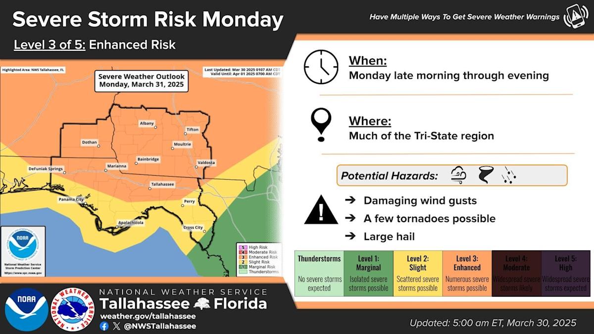
On Sunday, the National Weather Service in Tallahassee upgraded Florida’s capital city and areas along the I-10 corridor and north of it to a Level 3 of 5 enhanced risk for severe storms on Monday.
“Increases in the tornado (10-14%) and damaging winds (30-44%) probabilities largely drove the risk up,” forecasters wrote in their Sunday morning discussion.
The storm threat kicks off late Monday morning and could stick around through the evening. Residents in Tallahassee, Marianna, Bainbridge, Valdosta, and nearby areas should have a way to get alerts — whether it’s a weather radio, phone notifications, or local news updates.
The storms could bring the potential for power outages, downed trees, and dangerous driving conditions.
The main threat will come with “an organized squall line” though “discrete storms out ahead of the main line will also be capable of producing tornadoes and/or hail, especially if they become supercellular.”
Forecasters say the storm system will be fueled by favorable atmospheric conditions and a daytime passage that will enable the system to take advantage of the heat of the day. Still, they noted preceding convection or thick cloud cover could create a “failure mode.”
The National Weather Service has upgraded the risk of severe weather for the Tallahassee area on March 31.
The storm will usher in a weak cold front early next week, to be replaced by above-normal temperatures with highs in the mid-to-upper 80s.
This article originally appeared on Tallahassee Democrat: Tallahassee, North Florida face ‘enhanced’ severe weather risk Monday
Read the full article here


