A Tornado Watch has been issued for Champaign, Clark, Clinton, Greene, Logan and Warren counties until 4 a.m. on Thursday.
The National Weather Service canceled the Tornado Watch for Darke, Mercer, and Preble counties in Ohio and Wayne County in Indiana around 12:50 a.m.
The Miami Valley could see severe thunderstorms late Wednesday night.
A previously issued Wind Advisory for the entire region was canceled by the National Weather Service Wednesday evening.
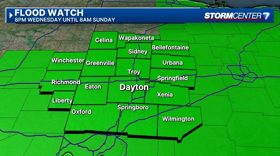
The National Weather Service has issued a Flood Watch for the entire region starting tonight at 8 p.m. and will last until 8 a.m. Sunday.

Photo from: Britley Ritz/Staff
[DOWNLOAD: Free WHIO-TV News app for alerts as news breaks]
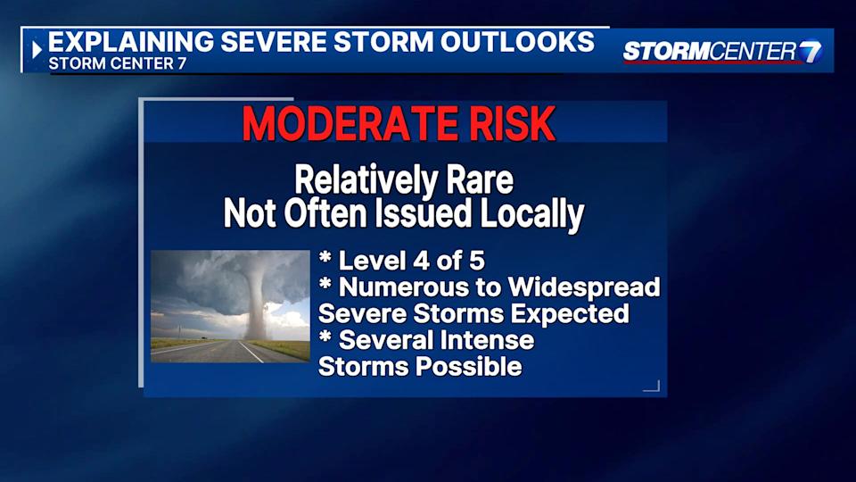
Some counties have been upgraded to a Level 4 of 5 Moderate Risk of severe weather for even higher confidence in widespread damaging winds that can exceed 75 MPH, according to Storm Center 7 Weather Specialist Nick Dunn.

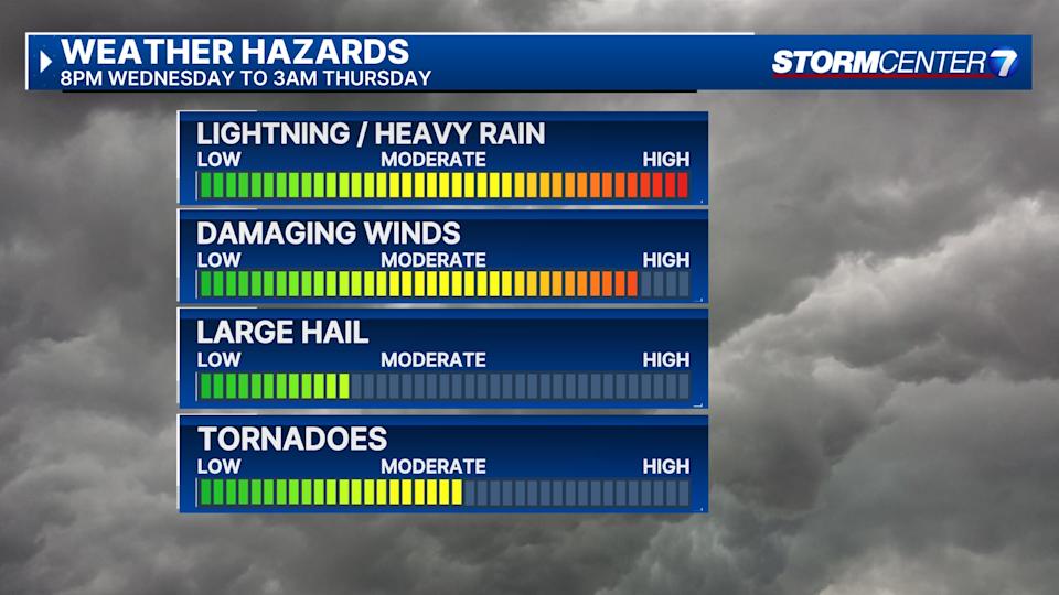
All severe weather threats are possible from these storms, including damaging straight-line winds, tornadoes, and hail.
While wind is our primary threat, the tornado threat is increasing. The region could see some strong tornadoes, EF2 or higher, with winds over 110 mph.
“Timing holds from 9 pm Wednesday evening through roughly 3 am Thursday morning for the strongest storms,” said Ritz. “We will be watching for discrete rotating storms just ahead of the line from 7-9 pm.”

With storms on Wednesday and later through the weekend, there will be a threat of flooding with several inches of rainfall possible.
Ritz says we could see upwards of four to eight inches of rain through Sunday.
After the storms move out Thursday morning, there will be an additional risk for severe weather Thursday evening.
TRENDING STORIES:
The risk level is currently a “marginal” risk, or 1 out of 5, for most of the area with damaging winds as the primary threat.
This story will be updated.
[SIGN UP: WHIO-TV Daily Headlines Newsletter]
Read the full article here
