


A cold front is moving through Florida today, April 11, as drought conditions prompt the National Weather Service to issue red flag warnings for several counties.
Northeast Florida could see locally heavy downpours today as the front moves through, according to the National Weather Service Jacksonville.
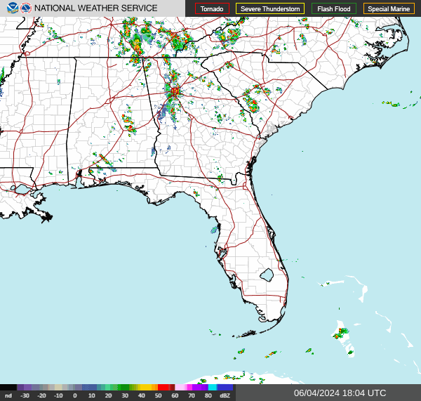
The front is expected to weaken as it moves south.
➤ Weather alerts via text: Sign up to get updates about current storms and weather events by location
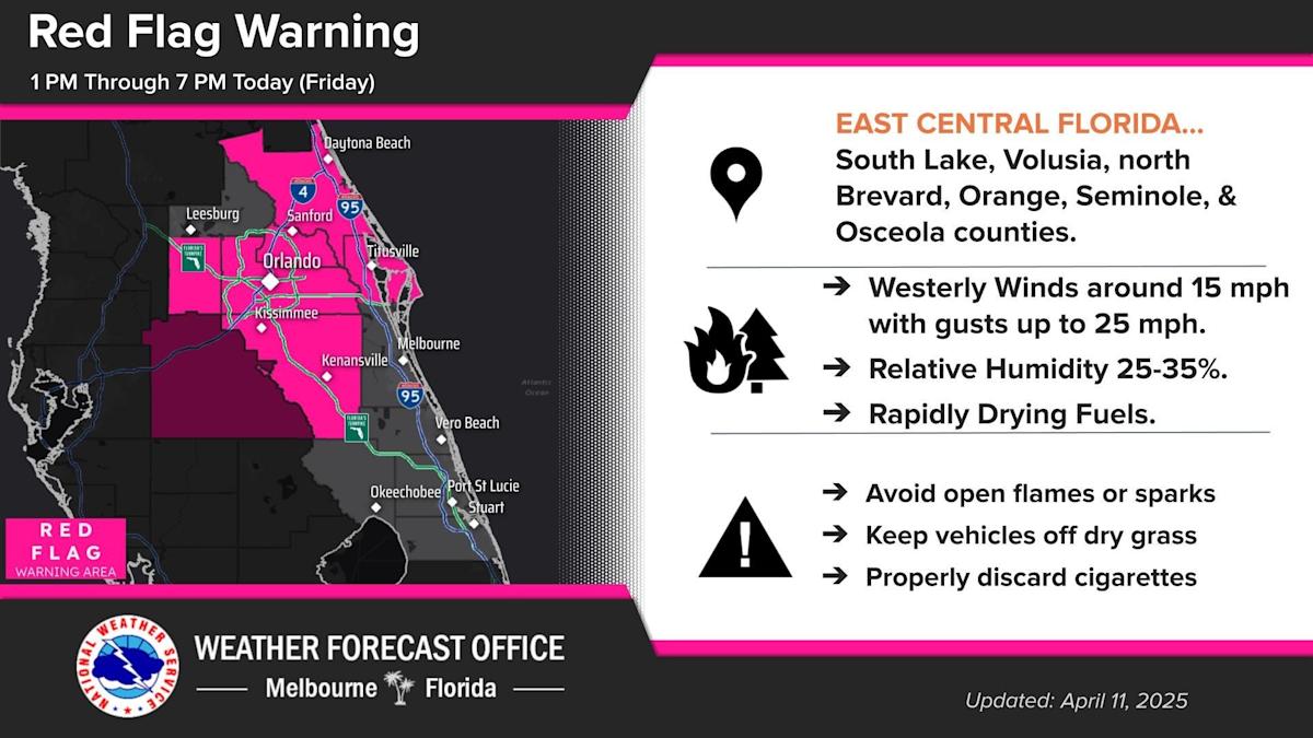
The National Weather Service issued red flag warnings for seven counties early Friday along the central and east coast of the state.
Friday morning, there were 39 wildfires burning, up from 33 Thursday, according to the Florida Forest Service.
The average statewide drought index increased Thursday to 348, up seven points from Wednesday’s 341.
Red flag warning in effect for 7 Florida counties
A red flag warning is in effect for seven counties April 11, 2025.
The National Weather Service has issued a red flag warning for seven counties:
What is a red flag warning?
A red flag warning is issued when “critical fire weather conditions” are in place.
“A red flag warning means warm temperatures, very low humidity, and stronger winds are expected to combine to produce an increased risk of fire danger,” the National Weather Service said.
What should you do — or not do — under a red flag warning?
Forecasters said residents under a red flag warning should follow this advice:
-
If you are allowed to burn in your area, all burn barrels must be covered with a weighted metal cover, with holes no larger than 3/4 of an inch.
-
Do not throw cigarettes or matches out of a moving vehicle. They may ignite dry grass on the side of the road.
-
Extinguish all outdoor fires properly. Drown fires with plenty of water and stir to make sure everything is cold to the touch. Dunk charcoal in water until cold. Do not throw live charcoal on the ground and leave it.
-
Never leave a fire unattended. Sparks or embers can blow into leaves or grass, ignite a fire, and quickly spread.
See the map: Active wildfires reported across Florida
Where are the largest fires currently burning in Florida?

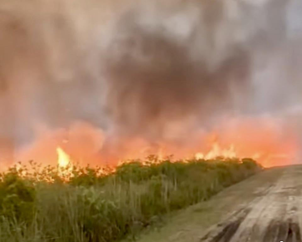
Wildfire at Lake Woodruff in DeLeon Springs
According to the National Interagency Fire Center, the largest wildfires burning in Florida as of April 4 were (data is updated every Friday):
-
Fernadez Fire: Four miles northeast of Lake Kathryn. 565 acres. 80% contained.
-
Red Horse Fire: Fire started on private land seven miles northwest of Bowling Green. 390 acres. 95% contained.
How do Florida brush fires get their names?
“Wildfire names are generally based on the geographic location of the fire or a nearby geographic feature,” according to Tim Brown, communications manager with the Florida Forest Service in an email.
“For example, the “344 Fire” was due to its location near 344 Street.”
Will it rain today in Florida?

Forecast for Friday, April 11:
-
Western Panhandle, Pensacola: Storms moved through the area Thursday day. On Friday, expect sunny skies, winds gusting as high as 20 mph. High 77. Low 54.
-
Central Panhandle, Tallahassee: A few strong to severe storms are possible Friday afternoon. Watch for gusty winds and possibility of hail. High 79. Low 52.
-
Northeast Florida, Jacksonville: Isolated strong to severe thunderstorms are possible Friday. Wind gusts of 40 to 60 mph and small hail will be the primary threats. High 81. Low 56.
-
East Coast, Central Florida from Daytona Beach to Stuart: Rain showers and isolated lightning storm chances will be small as a weakening cold front moves through the area Friday night. High 84. Low 61.
-
South Florida, West Palm Beach, Naples: Scattered showers will be possible Friday afternoon into the early evening. High 78. Low 66.
-
Southwest Florida, Fort Myers to Sarasota: There’s a risk for severe storms, mainly across the Nature Coast Friday evening into the nighttime hours. High 75. Low 66.
Interactive map: Enter your address to find closest wildfire risks
Current drought conditions in Florida
The Keetch-Byram Drought Index average for Florida was 348 Thursday. The drought index uses a scale from 0, which is very wet, to 800, which is very dry.
Dry conditions on the weekend, combined with falling relative humidity is expected to bring “sensitive to locally elevated wildfire conditions” throughout the state Saturday, according to the Florida Department of Emergency Management.
As of Thursday, April 10, there were 17 Florida counties with a mean Keetch-Byram Drought Index over 500, which means drought or increased fire danger. One county, Lee, has hit 600.
Another 13 of Florida’s 67 counties have index numbers in the 400s.
Five counties are within 25 points of hitting 500:
What do the drought numbers mean?
Here’s an explanation of what the Keetch-Byram Drought Index numbers mean, according to the Wildland Fire Assessment System.
-
0-200: Soil moisture and large-class fuel moistures are high and do not contribute much to fire intensity. Typical of spring dormant season following winter precipitation.
-
200-400: Typical of late spring, early growing season. Lower litter and duff layers are drying and beginning to contribute to fire intensity.
-
400-600: Typical of late summer, early fall. Lower litter and duff layers actively contribute to fire intensity and will burn actively.
-
600-800: Often associated with more severe drought with increased wildfire occurrence. Intense, deep burning fires with significant downwind spotting can be expected. Live fuels can also be expected to burn actively at these levels.
Burn bans in place for 7 Florida counties

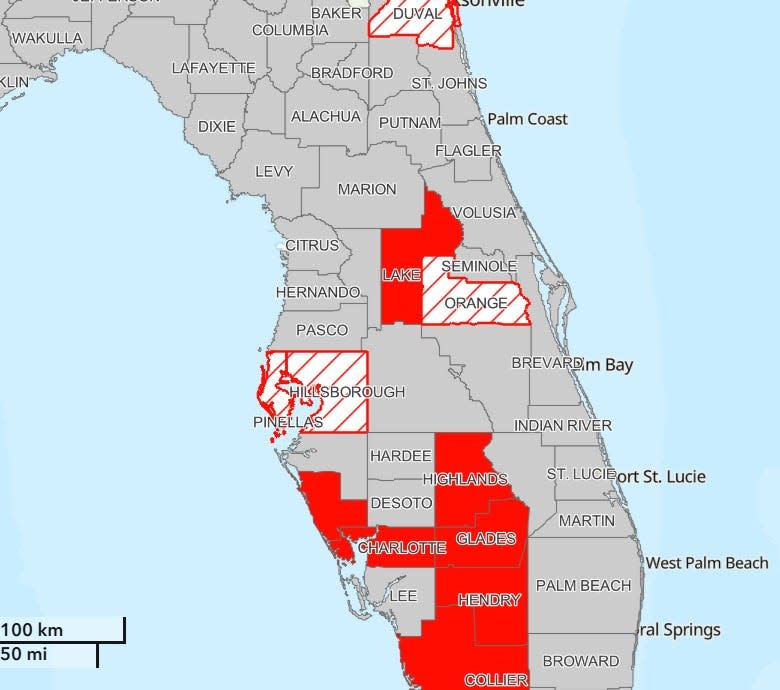
Burns bans are in place for several Florida counties as drought conditions continue April 1, 2025.
According to the Florida Forest Service, burn bans are in place for the following counties:
The open burning of yard debris is always prohibited in these counties:
Another weak cold front coming to Florida, with rain possible

Early Friday, a weak cold front is expected to bring some showers to portions of the state. A few locally strong thunderstorms capable of small hail can’t be ruled out, according to the Florida Department of Emergency Management.
By Saturday morning, the front will push offshore, bringing mostly dry conditions and elevated wildfire conditions to the state.
Temperatures to expect across Florida into this weekend
High temperatures will reach the middle to upper 70s across North Florida and lower to middle80s across Central and South Florida on Friday.
Slightly cooler conditions will keep high temperatures in the lower 70s across North Florida, middle to upper 70s across Central Florida and upper 70s and lower 80s across South Florida Saturday afternoon.
Low temperatures will fall into the upper 40s to lower 50s across North Florida and middle 50s to middle 60s across Central and South Florida Friday night.
By Saturday night low temperatures will fall into the 40s again across North Florida, 50s throughout interior Central and South Florida and middle 50s to lower 60s across coastal Central and South Florida.
Stay informed. Get weather alerts via text
What’s next?
We will continue to update our weather coverage as conditions warrant. Download your local site’s app to ensure you’re always connected to the news. And look for our special subscription offers here.
This article originally appeared on Sarasota Herald-Tribune: Florida wildfires feared from drought. Red flag warnings issued
Read the full article here


