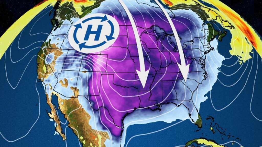
The season’s most drastic drop in temperatures is now plowing through the central and eastern states with dangerous wind chills and the arctic air could even topple some record lows.
Extreme cold warnings and cold weather advisories have been issued: Those alerts, which are issued by the National Weather Service, extend from the Midwest and Northern Plains to parts of the South and East.
The temperatures and/or wind chills that are expected or are ongoing in some of these areas could be dangerous, which means you should dress in layers and cover exposed skin. Steps should also be taken to protect water pipes from possibly bursting.
(MORE: What To Know About Cold Warnings And Advisories)
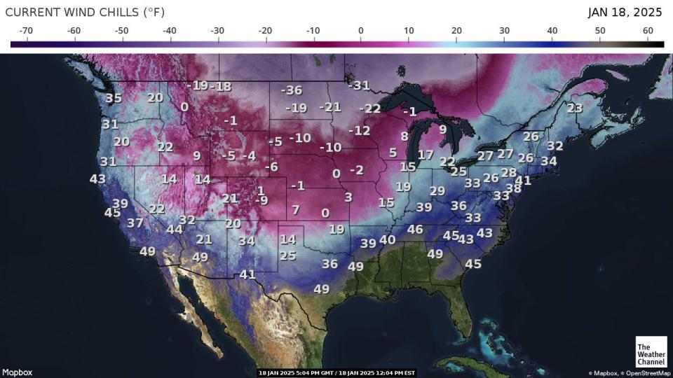
Below is a look at the latest wind chills showing where the heart of this arctic blast is located now.
(MAPS: Forecast Highs And Lows)

Frigid temperatures spread South and East: In general, most locations are seeing their coldest lows of winter so far. The peak of the coldest temperatures through midweek will be 20 to 35 degrees below average.
-
Cleveland could approach its daily record low of minus 10 degrees on Wednesday morning. Houston and Lake Charles, Louisiana, might also flirt with their daily record lows of 15 and 18 degrees on Wednesday, respectively.
-
Chicago, Denver, Detroit and Pittsburgh might see their first lows of the season dropping below zero.
-
Lows along the Interstate 95 corridor from Boston to New York and Philadelphia will be in the single digits by Tuesday and Wednesday morning.
-
Much of the South will see teens and low 20s for lows early this week, with parts of the Gulf Coast dipping to or below freezing.

Forecast AM Lows Next Week
Wind chills will once again be dangerous. The following three maps show the coldest forecast wind chills of the day on Tuesday and Wednesday. In most cases, those coldest wind chills occur early in the morning.
-
Subzero wind chills will grip a broad area of the Plains, Midwest and Great Lakes through Tuesday or Wednesday. Portions of the Northern Plains, upper Midwest and Great Lakes will see early morning wind chills in the dangerously cold minus 20s, 30s and 40s.
-
Wind chills in the teens and single digits will extend into parts of the South.
-
Many areas in the Northeast will see subzero wind chills by Tuesday morning.
(MORE: What The Wind Chill Means And Why They Are Dangerous)


(MORE: Why Minus 40 Is A Magical Number In Weather)
January’s cold start is notable for one reason: Record cold hasn’t been widespread this month, but what we’ve seen so far, plus what’s to come, makes it noteworthy from a persistence point of view.
Most areas east of the Rockies had temperatures at least somewhat below average for the first 13 days of the month as a whole, as shown in the analysis below from NOAA. Most notably, parts of the Plains, South, Ohio Valley and mid-Atlantic have been 5 or more degrees below average.
Many of these areas will continue to feel the brunt of this cold January pattern as we head into the month’s final stretch.

Chris Dolce has been a senior meteorologist with weather.com for over 10 years after beginning his career with The Weather Channel in the early 2000s.
Read the full article here
